The map of Kirkjubaejarkaustur city is a village situated in the south of Iceland. Kirkjubæjarklaustur map is located in an area of renowned natural beauty and mild climate. It’s so located that the town offers services like a fuel station, bank, post office and a supermarket.
Kirkjubaejarkaustur map has become a popular place for tourists. Nature-lovers and those who enjoy outdoor life have an almost unlimited choice of trips close by. Places of interest around Kirkjubæjarklaustur include the unusual rock formation of Systrastapi and Lake Systravatn, both connected in folklore with Kirkjubæjarklaustur’s medieval convent the hills at Landbrjótshólar, the Fjarðarárgljúfur canyon, and spectacular columnar basalt formations at Dverghamrar. Some other attractions being the Laki craters, the Eldgjá and Skaftafell National Park. One of the places to visit close to the village is Kirkjugólf (Churchfloor), a natural pavement made of basalt. These are basalt columns in the earth, which give the appearance of a paved church floor. This formation of lava is very similar to the Giant's Causeway in Ireland.
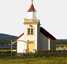
In the history of Kirkjubaejarkaustur it is believed that the Irish monks lived here before any settlement. The names of a waterfall and a lake have been kept after a monastery which was the convent to the nuns. Even the folk tales of history of Kirkjubaejarkaustur running in the village tell about the stories of good and sinful nuns. The Kirkjubæjarklaustur map came in the eyes of the world during the Lakagígar volcano eruptions in 1738. It is believed that a local pastor of the church delivered a sermon known as “Fire Sermon” which stopped the lava flow and saved the city. A church has been construted in the year 1974 in the pastor’s memory. |


